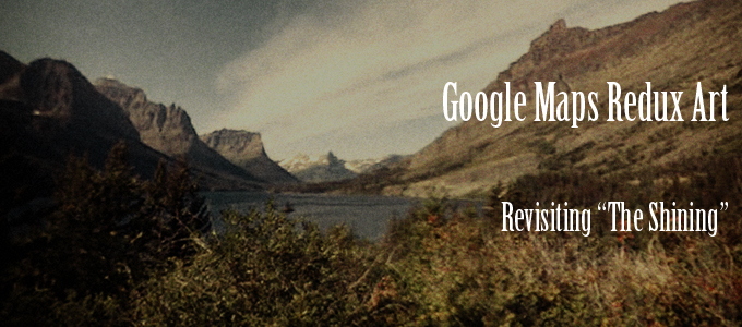
Dick Travels up the Mountain – Revisiting “The Shining” – Google Maps Redux Art

2013shiningsnowcattotherescue[clear]

The Snow Cat to the Rescue – Revisiting “The Shining” – Google Maps Redux Art

2013shiningsnowcattrip[clear]

Snow Covered Trees – Revisiting “The Shining” – Google Maps Redux Art

2013feb10googleoverlooksnowedincaption[clear]

The Overlook/Timberline from the Road – Revisiting “The Shining” – Google Maps Redux Art

In the 4 P.M. section of The Shining, Dick travels in the Snow Cat to the lodge. One shot has him on a fairly flat stretch hemmed with trees. I looked around for something corresponding to this and I don’t know if I might have lucked upon that exact stretch on the west leg of the Timberline Highway, which in the winter joins with the ski trails as part of that veritable maze before the Timberline, then links up with the Timberline Highway to enter from the east. I’d thought possibly that this scene was filmed at the studio as it was so eerily pristine, but seeing the Google Maps images, and knowing they had filming crew up here, it could have been a real location shot.

Wonderfully, Google Maps also provides an image that is very close to what Dick sees of the lodge as he approaches it from the road.

Continue reading “Dick Travels up the Mountain – Revisiting “The Shining” – Google Maps Redux Art”

The Timberline/Overlook Blanketed in Snow – Revisiting “The Shining” – Google Maps Redux Art

2013bestwaytolodgecaption[clear]

Best Way to the Lodge – Revisiting “The Shining” – Google Maps Redux Art

In the 8 A.M. section of “The Shining” we get a brief look of a view of the studio lodge from the far west entrance, which was unobserved on Closing Day. Though the studio set is different from the real Timberline (which is viewed in aerials and from down the mountain), it’s interesting to compare the live Timberline/Overlook snowed in version with the studio Overlook.

Continue reading “The Timberline/Overlook Blanketed in Snow – Revisiting “The Shining” – Google Maps Redux Art”

Dick in Denver – Revisiting “The Shining” – Google Maps Redux Art

2013shiningstapleton[clear]

The Airport – Revisiting “The Shining” – Google Maps Redux Art

2013boulderwestexitcaption[clear]

Boulder and Westminster Exit from the North – Revisiting “The Shining” – Google Maps Redux Art

2013boulderwestexitfromsouth[clear]

Boulder and Westminster Exit from the South – Revisiting “The Shining” – Google Maps Redux Art

In the 8 a.m. section of The Shining, Dick flies to Denver from Miami. The Stapleton International Airport is now closed. In the film we see road shots of snow, the Boulder/Westminster exit and wreckage of a Mack truck and VW. I read that the film crew who shot at Glacier National Park was also shooting road scenes in Denver. If the shots of the Westminster/Boulder exit were made in Denver, the roads have changed greatly since then so there is no recognition factor.

Continue reading “Dick in Denver – Revisiting “The Shining” – Google Maps Redux Art”

View Down the Overlook/Timerline Mountain – Revisiting “The Shining” – Google Maps Redux Art

2013feb10viewdownslopefromoverlook[clear]

Viewing down the Mountain, Revisiting “The Shining”, Google Maps Redux Art

2013feb10viewdownslopefromoverlook2[clear]

Viewing down the Mountain 2, Revisiting “The Shining”, Google Maps Redux Art

Kubrick opens many of the sections with a shot looking up the mountain from below, such as here on Tuesday and here on Saturday. On the supposed intervening Thursday, when the lodge has been snowed in, Kubrick chooses instead to open with Wendy and Danny playing in the snow and Jack looking out the window.

The above spruced up shots from Google Maps give us an idea of what it is to look down the mountain from the lodge. One has the impression of gazing over the world, and even the maze itself, the world maze.

The studio set shows the maze in front of the lodge. Though the hedge maze is clearly not observed before the real Timberline in aerial shots and the looking-up-from-down-the-mountain shots (because, of course, it wasn’t there in real life) and in some books the studio facade and maze is stated to be behind the Overlook, the Snow Cat’s approach to the real Timberline/Overlook strongly suggests we should see the studio maze as in the front.

What we never see in the movie, which can be observed in Google Maps, is that the mountain before the lodge is a veritable maze of ski slopes traversing every which way. With the tall trees acting as obscuring maze hedges, try entering this without directional guide posts. Even with guide posts observed in Google Maps, it is easy to become lost.

shining_skiareaaasmaze[clear]

Continue reading “View Down the Overlook/Timerline Mountain – Revisiting “The Shining” – Google Maps Redux Art”

Closing Day Mountain Ascent – Revisiting “The Shining” – Google Maps Redux Art

2013shiningfamilygoesupthemountain[clear]

The Torrance Family Travels Up The Mountain on Closing Day – Revisiting “The Shining” – Google Maps Redux Art

The above image is at the point when Kubrick crossfades from the Torrances driving to the vista of The Overlook.

2013shiningweepingwall[clear]

The Weeping Wall – Revisiting “The Shining” – Google Maps Redux Art

The Torrances are traveling west to east.

I had thought to pinpoint the opening waterfall shot as being at the Weeping Wall on the Going-to-the-Sun Road–before the Donner’s Pass conversation, and then not far after that the cross fade occurs (place of top shot) to the Timberline/Overlook. The day Google Maps went through there was road construction with a lot of dust and the sun glaring in their eyes–and viewing it all I can tell you that traveling with the sun in your eyes on the Going-to-the-sun-Road, with its challenging terrain, is not a road I would want to undertake with the sun blinding me.

shining_waterdrainage[clear]

The Torrance Family Passes Through a Water Run-off Area – Revisiting “The Shining” – Google Maps Redux Art

But rather than passing the Weeping Wall (the highway there is ever under construction for repairs due constant water damage) they may instead be traveling a little further along in Google Map 4 below (and the above street view). The lack of trees on the right fits better, plus the Google maps aerial view of the road seems to be a perfect match with the helicopter view from the movie. Which you can’t tell from a ground shot.

The image I’ve grabbed of the beetle nearing the bend (at the point of the cross-fade to The Overlook) is about two Google maps arrow clicks further past the two parking areas to the right as back at that point the sunlight was too glaring to get much of anything.

What’s interesting about this is that the Torrances are traveling west to east on Closing Day and Kubrick chooses to crossfade away to the Timberline/Overlook before they come to Logan’s Pass, which is right about the Continental Divide, a little west of it. Whereas when Jack is traveling east to west in the opening shots, Kubrick chooses to crossfade away to the Timberline/Overlook before he reaches Logan Pass as well. So, these two versions of the same trip are converging on Logan Pass (perhaps a kind of stand-in for Donner’s Pass) and the Continental Divide.

shining_windowbeetle[clear]

Background While Talking about Donner’s Pass – Revisiting “The Shining” – Google Maps Redux

The background out the window during the talk about Donner’s Pass. See this location in Google map 5.

Continue reading “Closing Day Mountain Ascent – Revisiting “The Shining” – Google Maps Redux Art”

Behind the Boulder Apartment Building (Revisiting the Shining) – Google Maps Redux Art

2013shiningrearofboulderapartmentcaption[clear]

2013shiningboulder[clear]

Thank you to Tom Rouse who left the coordinates for the Boulder apartment complex of the Torrances (the facade) in a comment on an article at the Examiner. He misnamed the apartment complex as the Kimberly when instead it is the Kensington. The Kimberly apartments are in roughly the same area, about two miles distant on Thunderbird Circle. The Kensington apartments are at 2950 Bixby.

But no matter the misname! He left the coordinates! Thank you!

The complex (pretty large) has buildings on four sides, for which reason I was unable to get a view of the mountains from beyond the parking lot, and so settled on a view of the rear of one of the buildings near an entrance.

Here is their FB page where you can some sample pics of apartments. Here are reviews on them at apartment ratings. Sounds like the kind of inbetween here and there place at which the Torrances might have landed.

They’re right off Highway 36, and a couple of blocks over you can still get a good view of the mountains from the highway. Back in 1980 the Kensington was probably the very edge of town, and is still pretty close to it.

2013shiningrearofbouldermountainscaption[clear]

Continue reading “Behind the Boulder Apartment Building (Revisiting the Shining) – Google Maps Redux Art”

Last Shot of Glacier Park on Interview Day – Revisiting “The Shining” – Google Maps Redux Art

2013shiningfromglaciertooverlookopening[clear]

Near Logan Pass, at around the Continental Divide, Kubrick crossfades from footage of the Glacier National Park to The Timberline at Mount Hood, blending Mount Clements (I believe) with Mount Hood. The helicopter then hovers over the presumed Overlook. This is past Siyeh Bend on the Going-to-the-Sun Road.

Continue reading “Last Shot of Glacier Park on Interview Day – Revisiting “The Shining” – Google Maps Redux Art”

After the West Tunnel – Revisiting “The Shining” – Google Maps Redux Art

shining_kayak[clear]

After the west tunnel, cut to the yellow beetle passing through an alpine area without trees. After the bend, it will pass a car with a kayak on top coming from the other direction. This is a good way past Logan Pass, towards The Loop, and so is head of the next and last shot of Going-to-the-Sun Road in the opening sequence.

Continue reading “After the West Tunnel – Revisiting “The Shining” – Google Maps Redux Art”

Exiting the West Tunnel (Revisiting The Shining)

2013othersidewesttunnelcaptionwhite[clear]

Exiting the West Tunnel (Revisiting The Shining), Google Maps Redux Art

2013lookingbackon westtunnelcaption[clear]

Looking Back at the West Tunnel (Revisiting The Shining), Google Maps Redux Art

The yellow beetle enters the Going to the Sun west tunnel and then it exits and passes a car parked to the left. If we are in the beetle, not watching from the vantage of the helicopter, we have no clue what’s around the bend, except for more mountains.

2013roundingbendaftertunnelcaption

Rounding the Bend (Revising the Shining), Google Maps Redux Art

Continue reading “Exiting the West Tunnel (Revisiting The Shining)”